Text and photos: Akul Tripathi
Such was the destiny that the tale foretold. A destiny of impossibilities, a foray into a land that lurks beyond a looking glass. A journey from which you don’t bring back memories…instead, leave a part of you behind…a part that will forever exult in a bewitched land. For in each visit, the colours will be brighter, the smells headier and the fireflies will never doom you to darkness.
In a distant northeastern corner of the country, at a place that exists in the shadowlands of people’s cognisance of interest and geography – and perhaps due to that very reason – alive, in its own bubble, like a microcosm of eternity, there dwells an enchanted forest.
An enchanted forest
How far is far? Is it distance that makes it so? What distance? The one calculated with a measuring tape? Or is it the end beyond a chasm of ignorance – of not knowing? Is it the place beyond where your understanding of places ends? A place far from you or just one that is physically distant? And what happens when you reach a place which is both physically distant and beyond your understanding? What happens then, when your senses are beguiled and your mind stilled in an effort to fathom what you experience? I guess, it is for this feeling that the word enchanted had to be invented.
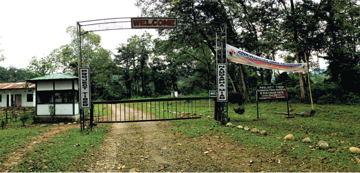
Namdapha is India’s third largest national park in terms of area (1985 sq. km), and is tucked away in its eastern most corner, in the state of Arunachal Pradesh, with its three sides bordering Myanmar. It lies at the junction of three global biodiversity hotspots – the Himalayas, Indo-Burma and Mountains of Southwest China, and between two important river systems – the Brahmaputra and the Salween. The 71,000 square km landscape has seven important protected areas, including Namdapha National Park and Tiger Reserve.
Situated 516 km from Itanagar and 640 km from Guwahati, Namdapha was originally a reserved forest under the Assam Forest Regulation Act of 1891. It was declared a wildlife sanctuary in 1972, and later upgraded to a national park in 1983. Located in what is the Eastern Himalayan sub-region, it is one of the richest biodiversity hotspots in India with a wide altitudinal range between 200 metres to 4571 metres above sea level. This altitudinal variation allows it the unique distinction of being a forest that is home to all four big cats – the tiger, the leopard, the clouded leopard and the snow leopard. Declared as a Tiger Reserve in 1983, it is also notably home to the Hoolock Gibbon – the only ape species found in India along with five species of the magnificent hornbills.
Just how mysterious this forest is, can be evidenced from the discussions and varied opinion on its very type. While all agree that it is an evergreen forest, some question its status as being a true rainforest. A rainforest is typically defined as a forest with between 250 and 450 cm of annual rainfall, with a small or by other accounts, an insubstantial dry season. They are the world’s oldest eco-systems and are believed to contain more than half of the world’s plant and animal species, though they occupy only between 5-6% of the earth’s surface area. Some estimate the number of plant species variations to be as high as two-thirds of the planet’s plant species. They are also referred to as the ‘world’s largest pharmacy’ due to the plethora of medicines natural, and those that can be derived from them.
Rainforests have been broadly categorised as tropical – those being near the equator, and temperate – between the tropics and the polar ice caps. Namdapha is labelled variously as a tropical rainforest, temperate rainforest and sometimes more specifically as a lowland evergreen rainforest. While decisions about titles are best left to experts, what is unquestionable is that it does meet the rain criterion and has large trees of species which are found in rainforests. For visitors, forests of Namdapha, along with the shola forests of the western ghats, is the closest one can come to experiencing what it would be like to visit the Amazon rainforest or others of its kind, along the equator.
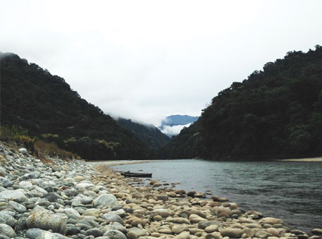
Namdapha’s distant location and the comparatively scarce information available about it and about what’s in it, has quite often led it to be called ‘India’s secret rainforest’, ‘virgin forest’ and other similar epithets. Situated in the Changlang district of Arunachal Pradesh, it is located a few kilometres away from the town of Miao. Misty hills herald its approach and the Noa-Dihing River coming from within its confines, stands also as its guardian moat.
The forest department has set up a roadblock indicating its official beginning, and on either side of the road – if one may call it that – is the definition of the word ‘impenetrable’. A mass of vines, shrubs and small trees obliterate anything beyond the first layer of pruned trees and bushes that threaten to devour the road at any instant. Tall trees line the road as a guard of honour and double up as stanchions, and the thickets being the velour fastened between them that keeps the jungle at bay.
Somewhere along this way, the road finally drops all pretences and accepts its true identity as subservient to the forest it serves, and wearily takes on the title of a rough hewn path, with rough being the operational word. At its end, with an almost palpable sigh of relief, it opens into a clearing and deposits its charge – us, and for somedays, even paths like it shall not grace our feet. We have reached Deban.
Into the secret rainforest
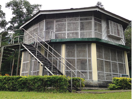
Deban is amongst the very few such clear spaces in one of Asia’s last and largest wilderness tracts. Situated at the edge of the forest, Deban is the entry point into the almost 2000 sq. km. of virgin forest area. Though a fully functional and operational site, facilities are rudimentary as compared to any other more popular (and easily accessible) national parks one may have visited. Set along the Noa Dihing River, it has several vantage points where time passes as effortlessly as the clouds over the Patkai Mountains in the distance. The Forest Inspection Bungalow offers accommodation of the basic kind, which when compared to further tent and camp accommodations,will soon seem luxurious.
At Deban, the forest guards and guides tell tales of the forest that leaves one spell bound. Many of these forest department employees with feet on the ground are of the Lisu tribe; who have lived in these forests for generations with the tribes themselves resident in eastern Arunachal and also neighbouring Myanmar. They do not speak of the forest as an entity that requires protection, but as a member of their family with its own needs that humans must fulfil and duties that it has honourably discharged for as long as there have been Lisu in the forests. Perhaps the most striking of the tales, a nugget of information that puts the vastness of Namdapha into perspective, is the admission that not even forest guards have seen or known the entire forest. At their estimate, accurate information and some sort of credible research is available for only perhaps a third of the forest. Perhaps other officers have at other times visited and some accounts exist. Yet, daily or even weekly patrols around the entire forest are almost an impossibility.
It seems almost incredible and perhaps unprofessional and inefficient that those responsible for the forest have not trekked and walked the extent of their domains. That is, until you see the forests and understand what it is like to walk in one of them. It is like penetrating the impenetrable. And this has to be done in a short period of time, as in a rainforest, when it rains, it literally pours.
To go anywhere from Deban into the forest is essentially a trek. There are no motorable roads beyond Deban, and walking is the sole mode of commute, with an elephant to aid at times. There are some campsites established by the forest department which function as overnight halts for the few dedicated visitors whose love for forest and adventure trumps their material cravings. Some local travel companies offer packages of treks along these routes, between the camps, of different durations, but usually circuitous, beginning and ending at Deban. In the dry season, there would be paths cleared of vegetation that one could walk on, but, like the forest guards say, the jungle claims it back every monsoon, and every year in the short dry season, the work to clear a path must begin again.
My visit in the relatively dry season of October-end and beginning of November was also not anywhere near as dry as one associates with the word ‘dry’. The soil was as wet from moisture and the occasional shower as it was soft, like a carpet, albeit a living one, covered with humus (Latin for ‘earth’) which is a spongy bed of decomposing leaves, and other organic matter. A vital function the humus performs is keeping water cycles alive. It acts as a large natural sponge, absorbing the water received during monsoons, releasing it slowly through the year, through a network of streams and rivers that feed the major rivers that flow through the forest and then one with the Brahmaputra, to quench the lands beyond…
Gigantic trees abound everywhere and the path picks its way along and around them. The largest trees, soaring well over 60 feet form the main canopy, and take in the most sunlight. The second layer beneath it can withstand about 60-70 percent of the sun’s brilliance. The third, even lesser, all the way to the shrubs at the ground, which need barely any light to grow and would wither if there was more sun. This means that every plant or tree depends on another to do its work to be able to live. As if understanding the necessity of having a symbiotic relationship to survive, even the path sometime gives up its crawling stride, ending at the trunk of one, and then after a small diversion through dense vegetation that wishes to hold you in its many tangles and keep you there, begins sheepishly from the other end of the trunk. Now imagine if there was no path. Shudder.
While rainforests are famed for their diversity, it is the flora and the fungal along with the earthworms, insects, butterflies and moths that one encounters that truly astonish. Butterflies the size of small birds, earthworms that could pass off as young ones of snakes, and insects that seem fed on steroids. In the grey light of perpetual shade, they seem at once eerie and impossible. And then along with this already blitzkrieg of an assault on the senses, the forest unleashes, what soon seems like its most abundant life form – the leeches.
Littering every trail and every inch of earth available, the leeches are strewn across the trails like flowers in a Roman triumph. The presence of warm blooded creatures wakes the beast in them, and they rise up in unison like heads of a subterranean hydra. With the spirit and tenacity of the serpents in Medusa’s hair, they are very adamant at wanting a suckle and squirt of fresh human blood through skin which is like paper when compared to their daily fare of other mammals. Their handicap of agility is made up by their persistence and flexibility, and once they stick to the shoe, they are able to squeeze through mere stitches and linings to feast on the feet. Specially made leech socks with no stitches for them to squeeze through allow the delay to swish them off the feet, as they make their relentless charge towards naked skin.
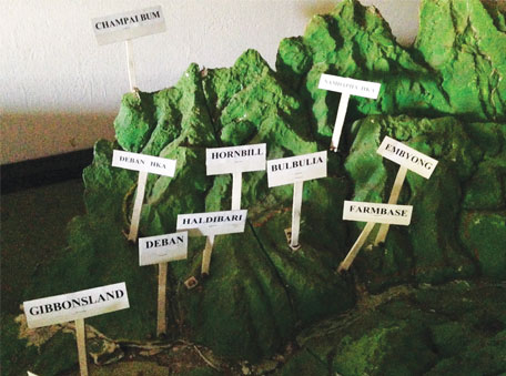
The trail I had set off on, led through a camp called Haldibari to the Hornbill camp, 9 km from Deban, and is so named as it is a homing ground for hornbills. While hornbills and their distinctive ‘whoosh-whoosh’ of flapping large wings could occasionally be heard and glimpses of the big birds were caught when not looking out for leeches, the frequency and population seemed to have greatly reduced from over a decade ago, when another group member had first visited.
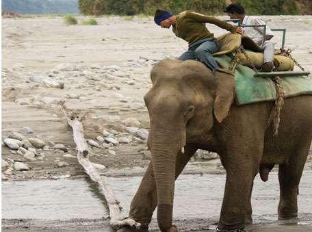
The wildlife of the Namdapha National Park and especially key species such as the tiger and large birds like the hornbill are believed to be at risk due to both poaching and the tribal culture of hunting. Animals are believed to be shy of humans for the very same reasons, and in an already difficult to navigate and visually challenging terrain for animal spotting, the shyness makes it ever more so.
The trekking route past the Hornbill Camp leads to another campsite at a place called Bulbulia. It is a particularly endearing camp site overlooking an aquifer, and derives its name from the sound of the several sulphur-methane natural springs that sprout here. Tribals call the place ‘Aji Polo’ which means the place of bubbling hot water. Bulbulia with its many watering holes is well suited to spotting wild animals coming over for a drink, especially at night. However, its immediate attraction is the possibility of starting a small fire on a make-shift stove of rocks by utilising the natural gas slowly seeping out with the water. The result is a miraculous fire on water display which is pretty to look at and quite a task to put out.
The trail from Bulbulia continues further to another camp called Firmbase, but this was the extent of my trek for the day and it was dark by the time I reached Deban. Night as it seems is the case with rainforests, comes on silent, swift wings and rather than descending unsuspectingly, which one quite expects, engulfs instantly. It takes a while to stop blinking and accept that it’s not the eyes that are at fault, but truly the light has simply vanished. The last part of the journey in the forest, before breaking out at the river banks was walked in complete darkness, and one realises the power and adaptability of the human body, with the eyes accommodating and actually adjusting to allow for a vision I didn’t know I had.
And though the stars and moon disappeared beyond the now imperceptible canopy, the fireflies were there to guide the way back home…
Some more secrets
The haze of distance clouds geography, no matter how easily accurate maps might be available. The kilometres that a place is away from wherever we call home, is directly proportional, in most circumstances to our knowledge and interest in that place. More so, if the places are not eulogised on social media and no Bollywood movies have been shot there. But then, the earth is a big, wide and wild place. Just how much can one keep track of…
To the north of the Changlang district is the Lohit district, named after the Lohit River – a major tributary of the Brahmaputra. The general area was once called the Mishmi Hills after the Mishmi people who live in the region, and the present name is believed by some to be derived from the Sanskrit Louhitya, meaning reddish or blood-coloured, and consists of the river valley and hills/mountains to the North and South. The Lohit district was in 2004 further divided into the Anjaw district which comprised the northern most part bordering Tibet (China) and Myanmar.
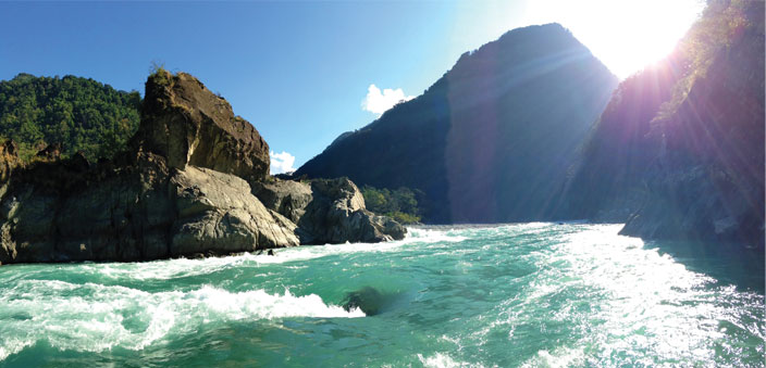
Well, all for the better as this allows for shocks, surprises and downright awe, when one finally does start thinking of travelling in these distant places. And suddenly from the mist of ignorance emerge whispers of fantastical proportions, and you wonder why is it that you never heard of them before. Such it was in the eastern-most part of the country, when the search for the mysterious enchanted rainforest revealed some other well kept secrets – a legend and some history.
The secret pilgrimage
I have always believed that our wise ancestors – the rishis who are the progenitors of wisdom, realised and took seriously the need for human beings to travel. They also recognised the infinite human potential for laziness, and in their peerless wisdom devised travel itineraries and worked it, perhaps consensually across faiths and doctrines, as the one thing that all adherents should do. As a branding exercise, they called it pilgrimage. And it’s a resounding success.
Not just in India, but across the globe, pilgrimage is the most popular reason for travel. The crisscrossing of India on various pilgrimage circuits is a particularly intricate weave, and seems designed taking into consideration weather and equal opportunity. Reasons for the pilgrimage are surprisingly repetitive across the locations – the purification of the spirit and the washing away of sin. Yet, the stories behind how and why this should happen are markedly innovative.
In the far Northeast, despite the strong Vaishnav connect in Manipur and the Mahabharata connections of Arjuna with Chitrangada and Ulupi and Bhima with Hidimba, mythological connections aren’t the first thing the mind draws up. Somehow, natural beauty always trumps in that race. Perhaps it is the lack of really popular pilgrimages beyond the Kamakhya Shakti peeth of Guwahati that stills the mind from exploring this direction. Which, as it turns out, was a good thing as it came as a pleasant surprise to hear of a relatively lesser-known pilgrimage for us from peninsular India – the yatra to the Parshurama Kunda.
Parshuram is considered the sixth avataar of Lord Vishnu who is said to have lived during the last Treta and Dvapara yugas and is considered one of the Chiranjivi (immortals). He is considered the ultimate master of warfare which he learnt from none other than Lord Shiva. Son of one of the Saptrishis, Jamadagni and Renuka, Parshuram is known for his wrath, piousness and two incidents which have shaped his story – his killing of kshatriyas twenty-one times over, and matricide.
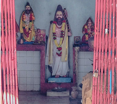
As per legend, Parshuram’s father was killed by kshatriyas, and when he reached his home he found his mother who beat her chest in grief twenty-one times. Parshuram took a vow of vengeance and waged war with the kshatriyas and rid the world of them.
In another telling, Parshuram’s mother Renuka is said to be such a devout lady that she could collect water in an unbaked clay pot which would be held together by the strength of her belief alone. However, on one such occasion, when she was collecting water for a ritual for her husband, a chariot of gandharvas flew over her and she lost her concentration for a moment, and the pot of unbaked clay dissolved into the river. Distressed, she just sat there not knowing how to show her face to her husband. Meanwhile, Jamadagni, through his powers, had already ascertained what had happened and he ordered his eldest son to slay his mother.
The son refused and the great rishi turned him into stone. The same happened with Parshuram’s other brothers. Finally, it was the youngest, Parshuram’s turn and ever-obedient, he beheaded his mother. Pleased, Jamadagni offered boons to his son and Parshuram wished for his mother and brothers to come back to life and not remember anything that had happened. While the family, through the grace of the boons came alive again, Parshuram was culpable of the sin of matricide.
Some versions of the tale speak that the axe used by Parshuram to kill his mother stuck to his hand. Jamadagni suggested that Parshuram do penance and travel the pilgrimage spots of India and bathe in their sacred waters. Through this, he assured his son, the sins would be washed away.
Parshuram, at his father’s suggestion, made all the major holy pilgrimages, but the axe remained glued to his palm. Then destiny took him to present Arunachal, and in Lohit district, in the Lohit River, Parshuram washed himself, and the axe came off and sank into the river! Thus, he was cleaned of his sins and the place this happened is the Parshurama Kunda. In memory of this, on every Makar Sankranti – when the Sun begins his northern sojourn in the month of January, people gather in large numbers at the Kunda, which unlike a lake in most places, is a flowing river, with the belief that like Parshuram, they too would be absolved of their sins.
As per other stories, it was the sins of killing kshatriyas that Parshuram washed away at this Kunda before setting-up the place as a sacred site. The priest at the Parshuram temple spoke of how the ‘mela’ (fair) at Makar Sankranti was getting bigger every year and not just local people, but others too would come from far and wide to pay their respects. Another local also spoke of how the Kunda was originally at a site under the current river flow, and the massive Northeast earthquake of 1950 changed the old site completely. Yet, mysteriously, massive boulders have embedded themselves in a circular formation in the river bed, thus forming another Kunda in place of the old one.
The walk to the Kunda is a fairly long one with a steep descent of stairs that take one to a rocky bank at a curve in the river, from where one gets a clear view of the Lohit valley as well. A perennial mountain spring joins the Lohit at this point and in a small niche, is kept an idol of the Chiranjeevi Parshuram. Would you think that he still comes here for a dip now and again? Perhaps disguised as one of the many mendicants who find their way here when the Sun enters the sign of Capricorn? I guess we will never know. After all, every age must have secrets to reveal. Maybe ours is just to discover this place. Or re-discover, shall we say?
The secret road to China
What if I told you it is possible to drive to China? Within a day? Technically, it is possible to drive from Dibrugarh in Assam into China within a day. That there are no immigration posts to facilitate it is a separate matter altogether. The mountainous road that traverses through Lohit district winds its way into the Anjaw district and marches on through valleys of vistas, ever northward, pauses at a small village called Kaho, beyond which begins the Chinese province of Rima.
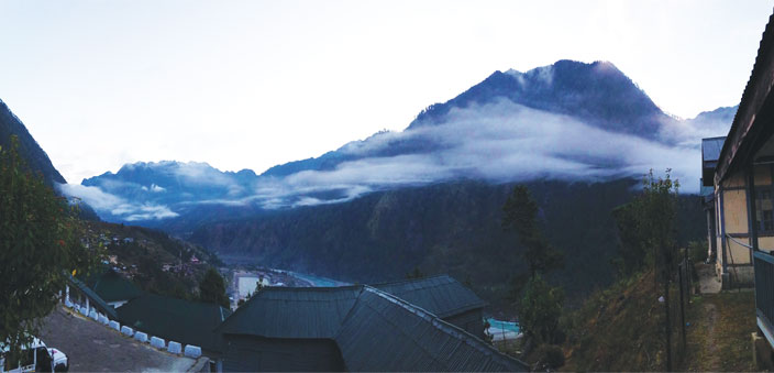
Unlike the high altitude border passes at Chushul in Ladakh, Nathu La in Sikkim or Bum La in Tawang in western Arunachal Pradesh, this road to Rima is quite convenient and a pleasant drive. In the days before the unfortunate war of 1962, some aged locals reminiscence, there used to be two major towns – Sadiya on the Indian side and Rima in Tibet. Post war, the borders lost all translucence and turned opaque, effectively an invisible wall.
Lore has it that this road to China was coveted by many. Early records claim that it was a matter of interest for Muhmmad Bakhtiyar Khilji – the general of Qutubuddin Aibak in the 13th century and then some centuries later, the Muhgal Emperor Aurangzeb, with aspirations of emulating his ancestors of the line of Genghis Khan and ruling over provinces of the Qing empire, sent Mir Jumla into Assam with intent to find this route to China. His expedition was thwarted however, by the Ahoms of Assam against whom he met with limited success, and had to finally recall his troops from the Northeast.
This road of perhaps 300 km into China, at a point that is much closer to the major cities of China, offers sensational possibilities for the future. That future, however, sleeps under the shadow of much pain and humiliation from the events of the Indo-China War of Walong of 1962, which India lost and where, as the Time Magazine summed up eloquently in its November 1962 issue, “…Indian troops lacked everything. The only thing they did not lack was guts.”
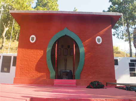
In October 1962, the Chinese exposed the unready state of the Indian military and the heroism of the Indian soldiers of the Kumaon, Sikh, Gorkha and Dogra regiments, who during the war, until the fall of Walong, fought shoulder to shoulder in unknown terrain against an enemy whose numbers seemed stretched to infinity. They say it is not uncommon to find remains of the war even now and fragments, live ammo and even scraps of uniforms can be found amidst the rocks, hidden in tall grass and amongst the pine trees of the mountains.
On the road to Kaho, one passes the former battle zones of Walong and Kibithu and another – Tilam – is just a short distance away. At Walong is a Hut of Remembrance that salutes the indomitable spirit of the Indian soldiers. Another plaque and memorial stands in the Namti plains outside Kibithu towards Kaho, and there is one also at Tilam. Reaching these areas today requires special army permissions. In fact, entering Arunachal itself entails having Inner Line Permits.
At Walong, a memorial that details the battles and blood asserts the Indian Army declaration that ‘Walong will never fall again”. Yes, it should never have to fall to war again. Nothing should. But perhaps, just maybe, if we manage to find a way paved with goodwill and cooperation, the small stretch between Kaho and Rima could be a smooth ride that connects and unleashes the potential of two ancient civilisations. Imagine then, the possibilities…

 >[/column]