QUEER, isn’t it? The corner of India that is the first to light up every day as the sun continues on its steadfast, unflinching route across the breadth of the country is amongst the least known, spoken about and nearly inaccessible areas of the country. Ironically, the norm suggests that it is places where the sun doesn’t shine which get condemned to the dungeons of indifference. However, the frontier states of Arunachal Pradesh, Nagaland, Manipur and Mizoram brave not just borders in the wilderness, but also the combined, colossal obliviousness of a nation whose mental borders are drawn short of its actual physical ones.
In the long shadows of dusk hides an old magic – the eternal lore of nature, the unmistakable and inimitable call of precarious thrill, legends which were once true, and amidst it all the sheer joy of discovering your own country. Some things choose to step away from the highlights of time just so that someday, some people can feel the adventure of finding it again. Perhaps those days are now and we are the lucky people who can reach into a paradise which is in its darkest phase – the one just before light. Where paradise unknown transforms into an enviable Eden. And when it does, this is what shall be unleashed on an unsuspecting nation.
Arunachal Pradesh
The largest of the Northeastern states, Arunachal Pradesh was aptly named so when it became a state in 1987. Translating as ‘the land of the dawn lit mountains’, the name holds special significance as it holds the most northeastern position in the country and borders three countries with Bhutan to the West, the Tibet autonomous region of China to the North and Myanmar to the East. The state is divided into five main regions with the Himalayas running north to south and the Patkai hills in the far east which feed numerous perennial rivers and rivulets, the mightiest of which – Siang, goes on to become the Brahmaputra. Modern-day Arunachal Pradesh is one of the linguistically richest and most diverse regions in all of Asia, being home to at least 30 and possibly as many as 50 distinct languages in addition to innumerable dialects and subdialects thereof.
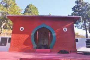
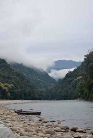
The easternmost point of the country lies in Arunachal Pradesh – Kibithu – the place which wakes to the first rays of the rising Sun over India. Kibithu is very uniquely located at a tri-junction, with China to the North and Burma to the East. Various hurdles need to be surmounted to get to the easternmost point of India. It is reached by a long, painful drive on the easternmost road of India, from the nearest big town of Tezu. Tezu itself is best approached through Assam, Dibrugarh being the nearest airport. Entry into Arunachal itself is a challenge with the necessity of an Inner Line Permit – another remnant from the grand colonial era and applicable in Arunachal, Nagaland and Mizoram. However, the troubles are compensated with interest by the serene landscape enlivened by the tranquil Lohit River, which enters India at Kibithu. Kibithu itself is surrounded by mountain passes which range from 1000 ft – 16000 ft and offers the option of many challenging treks. It is also the starting point for rafting expeditions.
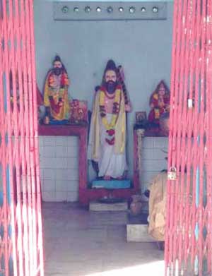
The serenity and setting of Kibithu make it seem like an idyllic place, unchanged and where nothing out of the ordinary would have happened since the mountains were formed and the river tore a path to the sea. How far it is from reality though! Just over 50 years ago, Kibithu was site to the Battle of Walong (Walong is a small town a few kilometres west of Kibithu) in the 1962 Indo-China War, where India suffered its worst military attack and subsequent defeat, throwing open a gaping hole at the border, and proving how unprepared India was, militarily and politically. At the same time, what stood out was the heroic resistance of the Indian soldiers. In November 1962, TIME magazine paid a tribute to the Indian soldiers who fought in the Indo-China War in Walong. It said, “At Walong, Indian troops lacked everything. The only thing they did not lack was guts”. A War Memorial at Walong and another one on the following Namti plains, pay homage to the 4000 soldiers who defiantly presented the ‘bloody nose’ to the Chinese.
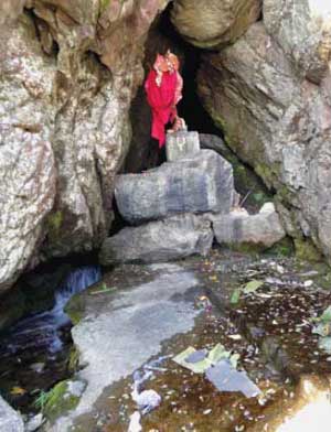
On the way to Kibithu, 21 kms north of Tezu is an important Hindu pilgrimage centre along the banks of the Lohit River – the Parshurama Kund, where according to legend, the great sage Parshuram washed away the sins of killing kshatriyas (cause the latter killed Prashuram’s father and waged a war against brahmins). The site sees devotees flock from across the country and even Nepal, especially on Makar Sankranti. As per local beliefs, the site as established by the sage was in existence till 1950, when a massive earthquake shook the Northeast and the kund was entirely covered. A very strong current now flows over the original site of the kund,but believers insist that the massive boulders embedded in a rough circle are forming another kund in place of the old.
Legends are made of these
During the invasion by the Chinese in 1962, the Indian army had withdrawn defeated from most quarters. However, some quarters were still manned by Indian troops. One such soldier manning an outpost was Jaswant Singh. He refused to withdraw from the lines and with the help of two locals Sela and Naranang, fought the Chinese. The two girls would reload the guns and he would arrange them strategically and fire them together by tying them with a string. In this manner he drove back two waves of the Chinese.
However the girl’s father went and spilled the beans to the Chinese. The Chinese now having the advantage of knowledge conquered the outpost. By then, Jaswant Singh had hung himself from a telephone wire and Sela had jumped off a cliff to her death. Naranang was caught and executed and so was their father. Once the war was over, Jaswant Singh’s name was on the Indian army’s list of deserters to face court martial. The Chinese, impressed by the soldier’s bravery narrated the incident to the Indians and declared that if the Indians did not honour Jaswant Singh, the Chinese would. Following this embarrassing incident for the army, Jaswant Singh of the 4th Batallion Garhwal Rifles was awarded the Mahavir Chakra (posthumous) and a shrine was constructed in his memory. Two peaks were named after Sela and Naranang. No roads and facilities existed in 1962 beyond Tezpur. The soldiers would go the entire way over the rugged terrain on foot. Just standing there looking at the wire on which Jaswant Singh gave his life for the country, one cannot but imagine the lives that these men live while we run for cover under the air conditioner once the mercury hits 30 degrees. The border areas of Arunachal continue to be manned by the Indian army and tensions often run high as large parts of the state are claimed by China.
Arunachal Pradesh is globally acknowledged as one of the foremost regions of the world in terms of bio-diversity. Paradise of the Botanists and Orchid State Of India are the other monikers bestowed on it. On its eastern border with Myanmar, Arunachal is home to India’s third largest and perhaps its most unique national park – the Namdapha National Park. It is the largest protected area in the Eastern Himalaya Biodiversity Hotspot. The park harbours the northernmost lowland evergreen rainforests in the world and is home to the four big cats – Tiger, Leopard, Clouded Leopard and Snow Leopard. Arunachal has perhaps the highest mammal diversity in the country with over 200 species and seven species of non-human primates including Stump-tailed Macaque and Slow Loris, Hoolock Gibbons, Capped Langurs, Assamese Macaques and Rhesus Macaques.
The park has 425 recorded species of birds and large areas of the park are still to be explored. Seated in the hills, Arunachal has very minimal and basic road network, a large part of which is constructed and maintained by the army. It is a large state and travelling from one end to another is quite a task as there are various natural hurdles which haven’t been circumvented or bridged. Fastest access from the easternmost part to the westernmost part is through the plains of Assam, which give way to the hills of Arunachal once again around the town of Tezpur and the climb begins once again into Arunachal and yet another picturesque drive to Tawang district in Arunachal Pradesh.
The town of Tawang developed around the Tawang monastery which has a very interesting story behind its making. The monastery was founded by Merag Lama Lodre Gyatso in 1681 in accordance with the wishes of the 5th Dalai Lama, Nagwang Lobsang Gyatso. Tawang in Tibetan means ‘chosen by the horse’ (Ta – horse; wang – chosen). Legend says that the Dalai Lama let a horse loose and instructed that the monastery be built at the place where the horse is found. Another version says that while Merag Lama was meditating on the problem of the location, his horse went missing and was found standing peacefully on the mountain top. Taking this as a divine guidance, the monastery was built at this place. It is also called the Galden Namgey Lhatse meaning celestial paradise and one look at the monastery on a clear night will make one realise how true its name is. Tawang was historically a part of South Tibet and though Tibet ceded large parts of its territory to the British as per the Simla Accord of 1914 between Great Britain, China and Tibet; which the Chinese did not accept and it became a bilateral agreement between the British and the Tibetan administration.
The British never took active interest or possession of Tawang and it was only in the late 1930s and 1940s that British troops asserted administration in the region. The situation continued after India’s independence but underwent a decisive change in 1950 when Tibet lost its de facto independence, and was incorporated into the newly established People’s Republic of China. In February 1951, Major Ralengnao ‘Bob’ Khathing led an Assam Rifles column to Tawang town and took control of the remainder of the Tawang tract from the Tibetans, removing the Tibetan administration.
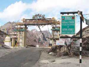
Tawang lies across the Sela Pass which is at a height of 13,700 feet above sea level following a high altitude lake of crystal blue water and rhododendrons running along the road in various colours and hues. During the Sino-Indian war of 1962, Tawang and areas up till Tezpur fell under Chinese control. An unforgettable battle at the pass, which is now the stuff of legends, led it to be named Sela Pass.
Nagaland
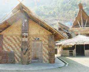
Nagaland, which was granted statehood in 1963 is one of the smallest Indian states and shares an international border with Myanmar. It is known in most of the country as a state rife with violence and Nagas are seen as people who wish to secede from India. The Nagas as they are generally called are actually people from several tribes, amongst which the Konyaks, Angamis, Aos, Lothas and Sumis are the larger tribes. These tribes are spread over the plains and hills of Assam, Nagaland and Arunachal Pradesh. Though a majority of the population in the state is Baptist Christian, tribe and clan customs and loyalties continue to play a major role. Over 60 different dialects from the Sino- Tibetan family of languages are spoken among the tribes while Nagamese, a variant of Assamese, is more commonly spoken. The scores of tribal dances and folk tales speak of a unique history of its peoples and a rich cultural diversity that deserves to be known far from its borders.
After Independence, Nagaland was a part of the Assam province and nationalist movements arose asking for a political union of the native groups. The Indian government saw it wise to quell these movements with the use of force, a strategy used right up till the late 1990’s, when cease-fire was declared after talks with the Nationalist Socialist Council of Nagaland. This ceasefire has since been extended several times, but it does not take a very close look at the news to realise that dissatisfaction is still palpable in the state.
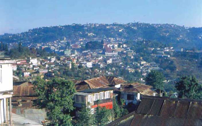
Nagaland shares borders with Arunachal Pradesh in the North and Manipur in the South, Myanmar to the East and Assam to the West. The best way to enter the state is through Assam via Dimapur. The entry into Nagaland brought us to our base camp for the state – Dimapur. While Kohima is the administrative capital of the state, Dimapur, meaning “city on the great river Dima” (Di – water/river; ma – big; pur – city) isthe commercial hub of the region and the point of entry for Nagaland and Manipur. Its strategic importance can be judged by the fact that the National Highway 39, connecting Kohima, Imphal and the Myanmar border runs through it.
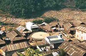
Dimapur in recent history is best known as a seat of the Kachari kingdom and the ruins of the Kachari Palace in the city are under the auspices of the Archaeological Survey of India (ASI). The advanced level of brick making achieved by the Kachari in the middle ages has perhaps allowed the many relics to survive the centuries, and ties in to the name given to Dimapur by the Ahoms (the dynasty from which the state of Assam is named) Che-din-chi-pen – the city of bricks.
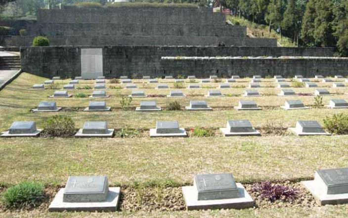
Onward from Dimapur, to the east lies Kohima – the capital of Nagaland, known as the ‘misty city’ and also the closest World War II (WWII) came to home. The Battle of Kohima was part of the Burma Campaign, which ultimately turned the campaign in favour of the Allies. The combined casualty list runs well over 10,000. The Earl of Mountbatten eulogised its impact on the War by comparing it to the Battle of Thermopylae. Twenty kilometres southwest of Kohima, at an altitude of 1200 metres is a little and little-known village surrounded by beautiful terraces cut out of the hill slopes. The Khonoma village, called Khwunoria by its dwellers is 400 years old and looks every year of its age. It gets its name from the Glouthera Fragrantisma locally known as Khunwo, the leaves of which are aromatic and cackle when burnt. The people of Khonoma declared 96sq km of their forests as sanctuary in 1998 to conserve the rare Blyths’s Tragopan, an endangered pheasant and the state bird of Nagaland. It is through this sanctuary that one gets to the valley of eternal charm. A further 10 kms from the Khonoma village, the Dzukou Valley is tucked away at an altitude of 2438m behind the Japfti ranges. Most of this remaining distance has to be covered through rough trekking. Famous for its biodiversity, the many streams that run through the valley freeze in extreme winter, while shrubs and herbs populate the stream banks of this predominantly bamboo -filled valley in the summer. In spite of the non-availability of facilities and the difficult terrain, this is one of the most frequented trekking spots in Northeast India.
Manipur
Standing at Kohima, there are two roads you can take – one towards Dimapur and then Guwahati, and the other that goes south, into Manipur – the road to Imphal. You don’t have to go too far down that one to know that it is definitely the one less travelled.
Bound by Nagaland to the North, Assam to the West, Mizoram in the South and Myanmar in the East, Manipur has been at the crossroads of Asian economic and cultural exchange for more than 2,500 years. It has long connected the Indian subcontinent to Southeast Asia, enabling migration of people, cultures and religions. It has also witnessed many wars, including fighting during World War II. In 1949, as per a treaty signed with Maharaja Budhachandra, the kingdom of Manipur merged with the Union of India. This was disputed by many groups and seen as a step taken under duress and without consensus, and is amongst of the reasons for a 50- year insurgency and ethnic violence.
Perhaps the roads have not been looked after and are less travelled too, as much to make it difficult for the many groups active in Manipur demanding separation from the Republic of India. The separatist movement that began in 1964 is very complicated as there are many factions involved. Their individual demands are also conflicting and come laden with the baggage of rivalries between different tribes. To illustrate the difficulties, while the Meiteis want a sovereign state for Mainpur, the Nagas want parts of Manipur to make for a greater Nagaland or Nagalim.
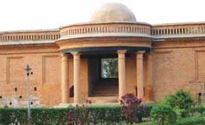
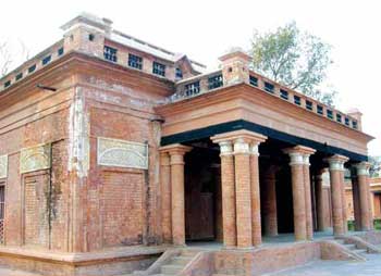
The capital of Imphal is best known for the historic Kangla Palace which was destroyed by the British in the Anglo Manipuri War and in recent history as the scene of one of the decisive battles of WWII. The Japanese, wanted to take over Imphal and Kohima, which were also heavily stocked bases of the Allies and then roll down to the Indian plains using the topography to their advantage. Their success in this would have been quite telling in the final result of the war. However, with exceptional bravery, clever stratagem and aided by the over-stretching of the supply lines of the Japanese, the Allies held on to the two towns. The battle is estimated to have caused causalities in the range of 100,000.

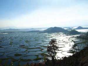
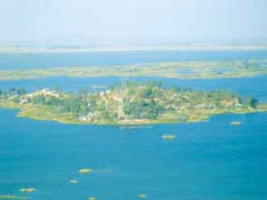
A two-hour bus drive, or approximately 50 km south of Imphal is the largest freshwater lake in the Northeast region. It is a swamp with floating vegetation, called ‘phumdi’. The phumdi is basically the accrual of organic biomass which floats, but is at places strong enough to support the weight of even humans. Loktak Lake is a unique bio-diversity hotspot and a Ramsar site (an international convention for safeguarding wetlands and associated wildlife). Occupying an area of about 40 sq. km., its name literally means ‘Lok’ – stream and ‘Tak’ – the end, referring to the many streams that feed the lake. The Loktak Lake is the core around which is formed the Keibul Lamjao National Park – home to the dancing deer of Manipur. Locally known as the Sangai, it is more commonly referred to as the brow-antlered deer and is one of three unique sub-species of the deer. The other two are found in Thailand, Myanmar and surrounding countries, but the Sangai is endemic to Manipur and naturally occupies a prominent place in local culture and folklore. Once thought to be extinct, it was rediscovered in 1975, and their numbers have increased due to conservation efforts and the establishment of the Keibul Lamjao National Park. The deer have adapted to the floating biomass and have mastered the trick of distributing their weight such as to almost glide over the phumdi, making it look like they are dancing. Besides the Sangai, the park is also home to 116 species of birds including species of migratory water birds from across the Himalayas. There are also over 200 species of animals including the rare Hoolock Gibbon (which is the only Asian ape), the Indian python, the Sambar and Barking Deer. It is touted, and probably is, the only floating national park in the world.
On the way between Imphal and Loktak is a site important in the history of the Indian freedom struggle. In the small town of Moirang, some 45 km south of Imphal where Colonel Malik of Subhash Chandra Bose’s Indian National Army hoisted the Indian tricolour for the first time on 14 April 1944. At the site is a museum containing letters, photographs, badges of ranks and other memorabilia.
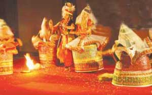
And amidst this chaos of internal violence, the one thing about Manipur that is definitely known around the country and the world is the classical Manipuri dance form inspired by the theme of Lord Krishna and his beloved Radha’s love story and the devotion of the gopis. The graceful dance with its elegant costumes has been put on the global map with its many performances at major world events with the backing of ISKCON (The International Society for Krishna Consciousness). Just the way not many know that the sport of Badminton originated and then developed from Pune in Maharashtra by the British, the game of modern Polo has its origins in Manipur dated by some as far back as 33 AD. The British first saw the locals play a rule-based pulu in the 19th century, which they spread first to Calcutta and then to Europe.
Mizoram
Mizoram – the land of the Mizo (Mi-people, Ram-hill) people; that distant block in the Geography textbook tucked away in a remote corner with a capital one would dread being asked about in exam papers – Aizawl.
The Mizos believe they came on to the Earth from the nether world. Mizo legends talk about their origin from under a large covering rock known as Chhinlung. When a couple of people from a clan called Ralte, who were known for their loquaciousness, started talking noisily while coming out and made much noise, the great God Pathian threw up His hands in disgust and decided enough is enough. He closed the pathway since he believed too many people had already slipped out from the Mizo Hades. It is believed that the Mizos came to Mizoram from the southern parts of China some three millennium ago. Some believe Chhinlung to be Sinlung or Chinlingsang situated near the Sino-Burmese Border. The Mizos themselves have fables of the glory of the ancient Chhinlung civilisation, which further lends credence to these beliefs.
A phenomenon associated with Mizoram is the flowering of the bamboo plants every 48 years which leads to what is called ‘mautam’ in the Mizo tongue – literally Bamboo Death. During ‘mautam’, a particular species of bamboo flowers at one time across a wide area which leads to a plague of black rats as they multiply in response to the temporary windfall in seeds. They leave the forests when the seeds are exhausted, and forage on stored grain, which causes a devastating famine. While there is occurrence of this in Manipur as well as Mizoram, the famine in Mizoram has had a telling effect on the region’s political history with the ineffective understanding and handling of the phenomenon in the 1959-60 famine coupled with the centralised Assam governance, which led to the creation of the Mizo National Front in 1961 that wanted independence from India. In 1971, Mizoram became a Union Territory and was declared a full-fledged state in 1987. In recent decades, life in Mizoram has been peaceful.
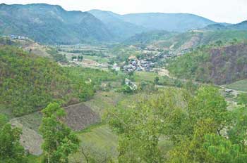
Mizoram is bordered by three of the seven sisters – Assam, Tripura and Manipur and shares an international border with Bangladesh and Myanmar. It is a highly literate agrarian economy which has seen significant growth in the horticulture and bamboo products industry. Like in most other parts of the country, modern development and architecture are making swift inroads replacing traditional lifestyles. Changes have been so radical in Mizoram, that just like Rajasthan has its Choki Dhani – a typical Rajasthani village recreated for tourists, Mizoram too has Reiek and Falkawn. Reiek is about 30 kms from Aizawl while Falkawn is 18 kms. The road is dotted with waterfalls and alive with butterflies. The drive to Reiek is pleasant through bamboo groves and tropical forest.
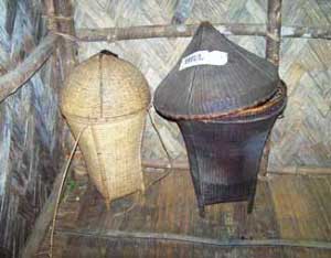
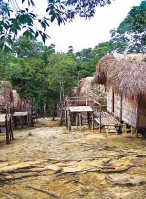
Though they are not as commercial or showcase as much diversity, the recreation is impeccable. Not just a house replicated with intricate detail, the entire structure of a typical Mizo village with the placement of the huts as per the prevalent hierarchies is maintained in the recreation. The houses are made with the same materials used by Mizos and contain everything a typical Mizo house would have.
To the other side of the hill where the typical village has been created are caves in which the ancient Mizos once lived. Pitch dark, wet and slimy, they are difficult to climb even with ropes while the villagers jump and run through them with the ease of mountain goats.
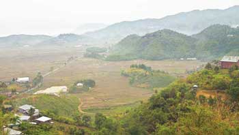
An interesting and unique occurrence in the state of Mizoram is at the picturesque border town of Champhai. The hill town of Champhai is a bustling commercial town and offers a wonderful view of the Myanmar hills. A storehouse of ancient relics, monuments and memorials connected with legends and folklores, Champhai has a background of rich heritage. The small hamlets around the town are dotted with monuments and monoliths that depict success in war, valorous hunting, personal distinctions and achievements. Champhai is significant for the Mizos because as per their fables, their ascent to earth happened near here.
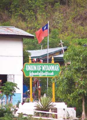
The Tiau Lui River that separates India from Myanmar is 22 kms from the town of Champhai. A metal bridge connects India to Myanmar across a shallow narrow river. The Myanmar flag stands proudly on one side while the Indian flag flutters on the other. However, unlike the China and Pakistan borders, this is a soft border. There is no fencing or no-man’s-land. People slip in and out quite regularly and the unique one-day visa formality is only for tourists who do not know of the thousands of pathways connecting Mizoram and Myanmar.
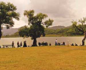
Just across the bridge are Burmese shops that stock excellent textile – batik shirts and wraparound skirts. A few kilometers away is the heart-shaped lake Rih Dil. The wonder of this lake is that though it has no visible external inflow or outflow of water, it is constantly clear and has invoked many interesting folk-tales. The Mizos believe that the departed souls make their way to heaven, which they call Pialral, through here. Permission to visit the lake is easily available through the Deputy Commissioner’s office and the Indian army, which has a very negligible presence for a border town, sends a representative along to accompany the tourists. Ethnically and culturally, this part of Myanmar is extremely similar to the way of life of the people of Mizoram. For this the Mizos have a joke; they call Rih Dil the largest Mizo lake which is in Burma.
An epilogue for ‘Big Brother’
Yes, they are a great distance away, these states. They are hard to get to and everything about them is completely unlike anything the mainland is habituated to expect from ‘India’. And yet, in the midst of this incalculable diversity, are people nursing the same aspirations as those anywhere else on the subcontinent. The desire to better their lives and the dream of an India bigger than the myopic glasses it received through centuries of dominion by forces from the west. Somewhere, we have forgotten to look east. And when we do, we will realise that it’s only the physical distances that are unalterable. The hearts – they beat as one.

