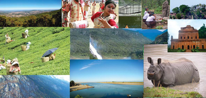
O upon a time, in a land far, far away, there dwelled people who had called it home for millennia, animals and birds that nobody knew or believed existed, and places teeming with timeless stories and memories that are lost to legends…
So begin fairy tales, and that is what any telling of Northeast India must be made to feel like, for an iota of poetic justice. It is completely unlike anything that through a myopic and ratings driven media, we have come to associate with India and Indianness (if there ever was such a thing!). Remarkably, for a species exceptionally adept at spotting and cultivating similarities between two apparently diverse subjects, opinions and peoples, the Northeast has surprisingly been mired in discussions which do exactly the opposite. This is the unfortunate legacy that we, the children of India, have inherited from the combined, mighty ignorance of two sets of leaders – one, the British, who wanted to get India off their hands as quickly as possible, and two, our elected representatives, who arrived blinking, surprised, and still delirious with incredulity at becoming custodians of a land astounding and unfathomable in its differences in language, customs, and history; a mere day’s walk from any point.
True, it is a different world in the Northeast and not one that most of us living in other parts of the country can inherently relate to. It is distant and not the most convenient to travel to. Languages and dialects are numerous; features of people starkly different and even the flora and fauna tend to appear fantastical and larger than life. The apprehension is natural. But let it not kill that universal spark of knowledge – curiosity.
Let’s be brave, let’s make that leap. Because we are not so different. Us and Them.
The Seven Sisters
The land beyond the Siliguri corridor, also known as the ‘chicken neck’ – as it’s a passage barely 21-40 km wide, sandwiched between Bangladesh and Nepal – has been known as the land of the seven sisters since the time the area was divided between the seven contiguous states of Assam, Arunachal Pradesh, Mizoram, Manipur, Meghalaya, Nagaland and Tripura. The sobriquet is believed to have been coined by a Tripura journalist, who also published a book on the interdependence and commonness of the region.
The land of the seven sisters is a true frontier province in the way that it shares an over 4500 km long international border with Bhutan in the Northwest, China in the North, Myanmar in the East and Bangladesh in the South. With an area of over 255,000 sq. km., it is roughly three-fourth the size of the state of Maharashtra, and almost seven percent of India’s total land mass. Physiographically, the region includes the area of the Eastern Himalayas, Northeast Hills, and the Brahmaputra and Barak Valley Plains. The region is drained by the prodigious Brahmaputra-Barak river systems and their tributaries. Roughly two-thirds of the area is hilly, interspersed with valleys and plains.
Within this playground lies a paradise which has been the melting pot of races, communities, peoples and cultures since before there was a concept of time. Its magical beauty is something we are just beginning to discover and appreciate. Its phenomenal biodiversity continues to bewilder and surprise, even though the forests have shrunk considerably. A treasure trove of natural resources including a fifth of the estimated natural gas and oil reserves of the country, the Northeast has invaluable potential in forest produce. It has been found to be rich in wild relatives of crop plants and is also considered to be the centre of origin of citrus fruits.
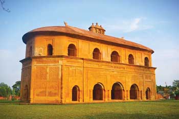
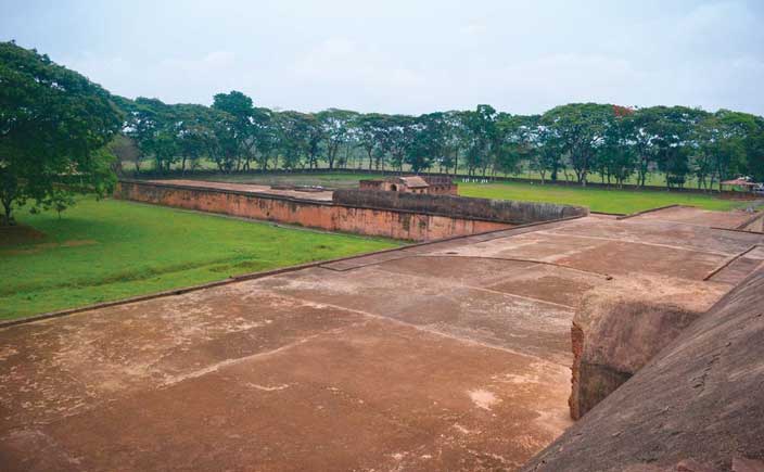
The Austro-Asiatic people (Latin for south Asia), are believed to be the first settlers in the region, followed by the Tibeto- Burmese and Indo-Aryan. It is found to have been a trade route from China as early as 100 BC through the references of Chinese explorer Zhang Qian. The Periplus of the Ethyrean ‘Rong Ghar’, an Ahom entertainment pavillion, Sivasagar, Assam Sea – a kind of detailed Lonely Planet for the ancient world dated to the 1st century CE, describes Northeast India as being inhabited by a people called Sesatai and the source of Malabrathum (cinnamon-like aromatic plant leaves) which held great value in the ancient western world. Various kingdoms founded by indigenous rulers and by those from the neighbouring provinces, held sway over the ensuing centuries before the British came to found the empire over which the sun did not set.

This is the only mainland region of India which saw action during the Second World War. Arunachal Pradesh, Assam, Nagaland and Manipur bore the brunt of this assault in what was a very important, and ultimately decisive chapter for the outcome of the War, and one which had a telling impact on the Indian independence movement.
At the formation of the Union of India, only three states covered this area. One large province of Assam with its capital at Shillong, and the princely states of Manipur and Tripura. Following the restructuring of India along ethnic and linguistic lines, four new states came to be carved out of the landmass. Nagaland became a separate state in 1963, followed by Meghalaya in 1972. Manipur and Tripura remained Union Territories till 1972, at which point they became full-fledged states. In the same year, Mizoram was made a Union Territory and achieved statehood in 1987 along with Arunachal Pradesh.
Assam
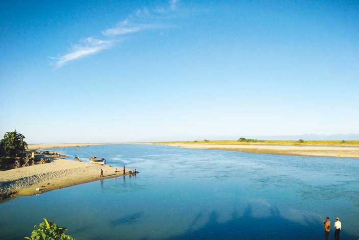
The state of Assam is the gateway to the Northeast and its capital Guwahati is the largest city in the region. It borders every one of the other six sisters and is in that manner very centrally located. After quickly descending through Tibet and Arunachal, the Brahmaputra takes shape as a braided river in Assam with the meeting of the Siang (Dihang), Lohit and Dibang rivers. The flood plains of the Brahmaputra and the Barak Valley are extremely fertile tracts of land, which are the back-bone of the agrarian economy.
The area has been inhabited since at least the period of the Stone Age. It has many references in mythology with the Kalika Purana mentioning Mahiranga Danav of the Danav dynasty as the earliest ruler of Assam. This dynasty was succeeded by the Naraka dynasty who the Mahabharata mention as having fought for the Kauravas in the battle of Kurukshetra under King Bhagadatta, who fought with an army of kiratas (mountain dwellers), Chinas (Chinese) and “dwellers of the eastern coast”.
Archaeological finds indicate that the region was the frontier of the Gupta Empire (320-550 CE) and constituted the kingdoms of Kamrupa (western Assam) and Devaka (central Assam). Later, the Kamrupa grew into a large kingdom covering all of the Brahmaputra Valley, North Bengal, North Bangladesh and at times, parts of West Bengal and Bihar. The Kamrupa kingdom was ruled by three dynasties over eight centuries – the Varman, Mlecha and Kamrupa Palas. Also known as Pragjyotishpura (light of the east), the kingdom disintegrated in the 12th century to be replaced by several smaller kingdoms, but its legacy persists in the form of the Kamrup district of western Assam, named after the Kamrupa kingdom.
Its other legacy is the revered Kamakhya Temple in Guwahati which is estimated to have been built and renovated several times between the 8th and the 17th century. Dedicated to the mother goddess Kamakhya, it is one of the oldest among the 51 shakti peeths. According to the Kalika Purana, Kamakhya Temple denotes the spot where Sati used to retire in secret to satisfy her amour with Shiva, and it was also the place where her yoni fell after Shiva danced with the corpse of Sati.
The next major kingdom to first grab a toehold and then dominate the entire region was the Ahom kingdom established by the Shan king Sukhapa in 1228. The Ahoms are believed to have come from the border region of present day Myanmar, Thailand and China. Some also believe that they brought with them the technology of wet rice cultivation. The kingdom maintained its sovereignty for over 600 years and successfully resisted Mughal expansion in the Northeast.
During the same period, three other notable kingdoms carved a niche for themselves in the region of Assam. The Koch kingdom in the 16th century in western Assam and present north Bengal which was established in 1510, and split into two in 1581 with the western half, Koch Bihar, becoming a Mughal vassal and the eastern, Koch Hajo, an Ahom satellite. Koch Hajo was subsequently absorbed into the Ahom state while Koch Bihar became a princely state before becoming a part of the Union of India.
The Ahom kingdom grew slowly for the first couple of centuries from the time of its inception and established its unique administrative and military systems (the Paik system) which fuelled its rapid expansion in the 16th century. This expansion was so sudden that it had a profound effect on the political and social life in the entire Brahmaputra Valley. What it also did was make the Ahom kingdom multi-ethnic and the Ahoms themselves became a minority in their kingdom. Their peculiar and highly organised systems were not easily adopted by the newer subjects. The many wars and infighting between the Tai-Ahom nobility led to further discord and deterioration of the kingdom’s rulership. The crippling blows to the kingdom came with the strengthening of the Vaishnav movement which was at odds with the Ahom administrative policies, and led to the Moa Moria rebellion causing huge civil unrest and chaos. The Burmese were invited into the land by dissatisfied branches of the nobility and with the British lurking around the corner for just such an excuse, its absorption into British India was only a matter of time, and it was annexed completely by 1838.
Their might can be imagined when one recounts that the Mughals at the height of their power, tried seventeen times to conquer the region to fulfil the Mughal aspiration of ruling over China like their illustrious ancestors – the descendants of Genghis Khan. Except for a brief period of less than a year where Aurangzeb’s governor Mir Jumla occupied Garhgaon, the then capital, the subsequent decisive victory by the Ahoms ended Mughal ambitions in the region.
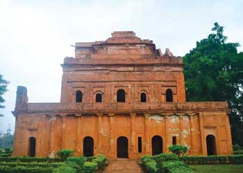
Their cultural endowment is humongous as the Ahoms were great builders as they were warriors and strategists. The largest concentration of Ahom era structures and architecture can be found at their capital cities of Sibsagar and Garhgaon in eastern Assam, between Jorhat and Dibrugarh. These remains include palaces, fortifications and their entertainment amphitheatre – Rong Ghar. The Ahoms have left an indelible impact on the life and culture and conscience of the people of Assam, which is evident in the name of the state itself, which according to one line of thought is derived from the word Ahom.
The British interest in Assam intensified on their discovery of the tea plant in the region in 1834. After unsuccessful attempts at creating a hybrid with the Chinese variety, the local tea was adopted by planters and the tea industry of Assam began in earnest in the mid-nineteenth century in upper Assam, where the climate and soil were more suitable. Within two decades, this industry which is still the biggest part of Assam’s economy, emerged as a profitable venture.
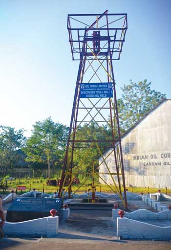
The importance of Assam for the British increased further as petroleum reserves, the first in Asia were discovered in Digboi, and the first oil well in Asia was drilled in 1889. The story of this discovery is as fascinating as the naming of the oil town of Digboi. A small group from the Assam Railways and Trading Co., exploring the region, found their elephants’ legs soaked in black mud which smelt somewhat like oil. Further exploration led to striking oil in 1889 and Assam Oil was formed in 1899 to look after the oil business in the area. The first oil refinery of Asia was also set up in Digboi in 1901. Why Digboi? It is said the name is derived from the phrase the British told the labourers who were digging for oil – “Dig, boy, Dig”!
During the mid-nineteenth century there were a few attempts by local leaders to free Assam from the British, which proved unsuccessful. After this, the Assamese joined and actively supported the Indian National Congress against the British. Initially part of the Bengal Presidency, it went through a few administrative revamps as the British Empire consolidated itself in India, and in 1912 it was established as the Assam Province and one of the eight major British provinces administered by either a Governor or Lieutenant Governor. This administrative arrangement continued till the partition of India, wherein Assam became a constituent state though a part of it from the district of Sylhet was given up to East Pakistan. Post-independence, the states of Arunachal, Nagaland, Meghalaya and Mizoram were carved out to satisfy the national aspirations of the tribal populations living within the then gigantic Assam state.
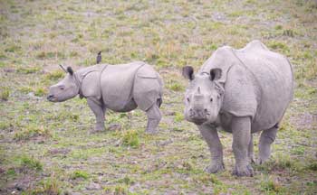
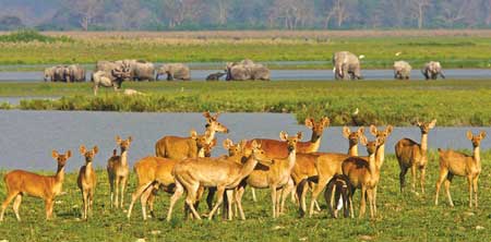
Despite the segregation into several states, Assam retains its place as one of the richest biodiversity zones in the world, and its wildlife areas include tropical rainforests, deciduous forests, riverine grasslands, bamboo orchards and wetland ecosystems. Within these are several endangered and threatened wildlife species of birds, animals and plants. It is the final bastion of the One-Horned Rhinoceros, hosts the largest population of wild water buffaloes in the world and highest bird diversity in the country with 820 species of birds. For protection of the ecosystems and its dwellers, several large tracts are now protected as national parks, reserve forests and wildlife sanctuaries.
The history of conservation in Assam begins with the efforts to conserve the Indian One-Horned Rhinoceros – more than two tons of frightening muscle and tank-like belligerence. With its armour-plating hide and its long horn – which really isn’t a horn, but compressed hair – the Indian rhino once ruled the roost in the wetlands of Northeast India. Hunted mercilessly, it was on the brink of extinction when conservationists awoke to its plight. The result, and a successful one at that, is Kaziranga National Park in Assam.
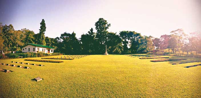
It was Lady Mary Curzon, wife of the Viceroy of India, Lord Curzon, who on a trip to the Northeast did not notice a single rhinoceros and brought it to the attention of the government, and the result was setting the land aside as a reserve forest in 1908. It was officially closed for shooting; at the time it could boast of only a few dozen rhinos. By 1950 the area was a wildlife sanctuary, and in 1974 it was designated a national park. Bounded by the misty blue hills of Barail and Karbi Anglong to the south, the national park was declared a UNESCO World Heritage Site in 1985. The other UNESCO site is the Manas National Park in the Himalayan foothills and contiguous with the Royal Manas National Park in Bhutan. An incomparable gift of Assam is the Molai forest – a manmade forest near Jorhat. Built single handedly by Jadav Paying of the Mishing tribe on a sandbar in the Brahmaputra, it is today a forest reserve frequented by wild elephants. The Molai forest is an indication of what is possible, were we to dedicate ourselves to the cause. Also near Jorhat is the largest riverine island in the world – Majuli.
Post its restructuring in the 70’s, Assam has seen the growth of armed separatist groups like the United Liberation Front of Assam (ULFA) and National Democratic Front of Bodoland (NDFB) amongst others. Illegal immigration, especially from Bangladesh with people seeking better opportunities is fast changing the demographic composition of the region. Combined with sluggish rate of development, the perceived apathy towards indigenous communities by successive state governments is causing resentment amongst the Assamese. Hopefully, talks shall triumph terror and Assam can lay full focus on the optimisation of all the potential that lies ready for flight in the state.
Meghalaya
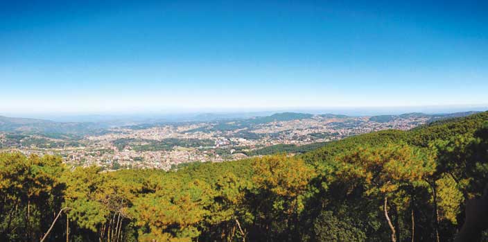
The ‘abode of clouds’ lies sandwiched between Bangladesh in the south and west, and Assam in the north and east. Shillong, the capital of Meghalaya, also known as the ‘Scotland of the East’, was once capital of Assam province before the new state of Meghalaya was formed in 1972. It is a mountainous state with the districts of Khasi, Garo and Jaintia Hills from the Assam Province forming the state of Meghalaya.
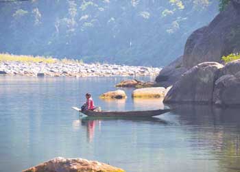
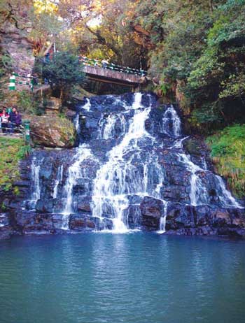
Meghalaya holds the distinction of being the wettest place on planet earth with the annual rainfall as high as 1200 cm in some areas. Cherapunjee has long held the record for the highest rainfall recorded in a single calendar month and nearby Mawsynram holds the title for the maximum precipitation in a year. This combination of high plateau land and abundant rainfall have made for a very advantageous position of safety from floods, and rich soil.
There has been limited archaeological study in the area but enough has been found to establish human settlement since ancient times. In fact, the neolithic era shifting cultivation or jhum as it is more popularly known is still practised in this largely agrarian economy which also depends quite heavily on the commercial forest produce acquired from the seventy percent of its land that is still under forest cover.

Day at Cathedral of Mary Help Of Christians, Shillong
In addition to having thriving subtropical forests, which are home to one of the richest botanical habitats of Asia, Meghalaya is amongst the handful of places left in the country which still protect and nurture sacred groves – small pockets of ancient forest, protected, maintained and worshiped by the locals due to religious and cultural beliefs. Along with the two sacred groves – Law Kyntang and Law Lyndhoh, there are other wildlife sanctuaries and national parks which harbour many rare plant and animal species. Amidst the presence of several species endemic to the Northeast, it is important to note that Meghalaya is also home to 250 butterfly species – nearly a quarter of all the butterfly species found in the country.
Before being integrated by the British, the Khasi, Jaintia and Garo tribes had their own kingdoms and these tribes make up for a a large majority of the Meghalaya demographic. Of these, the Khasis are the largest group followed by the Garo and then the Jaintias. Known as the ‘hill tribes’ these were amongst the first to be converted from tribal animist religions, beginning in the early 19th century with the advent of the British era. Today, it is one of the three Christian dominated states in the country (the other two being Mizoram and Nagaland), with over seventy percent of the population adherers of the Christian faith.
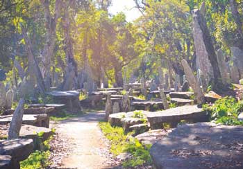
Amongst the Northeast states, Meghalaya has historically been the least troubled by violence and insurgents or separatists. This, combined with the pleasant climate, no special travel or inner line permit requirements, and proximity to Guwahati, have made it a popular tourist destination. Its natural legacy provides for ample opportunities for a variety of nature and adventure based tourism options. Rich in limestone deposits, research is revealing miles of subterraneous limestone caves which are still being explored and mapped. Some caves are making it to the longest and deepest record books, inviting still more tourists and caving enthusiasts. The many rivers and rivulets, mostly seasonal, are popular rafting options, and the clear, deep waters provide great opportunities for a touch of scuba diving. The largely unchanged way of living, especially in the more remote reaches of the state, the pristine environment and the large English speaking population are making Meghalaya an internationally renowned and vibrant tourist destination.
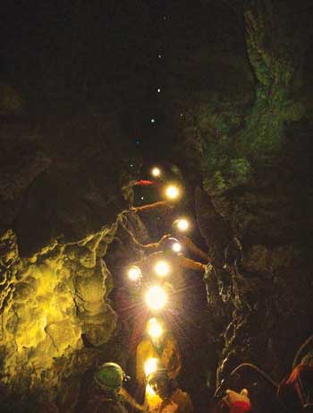
Meghalaya
Interestingly, all the three major tribes of Meghalaya are matrilineal societies – ones in which descent is traced through mother and maternal ancestors. It is probably part of the world’s largest surviving matrilineal culture. Matrilineal is not matriarchal. Women do not dominate men. Men have power, but it is inherited from the women. This might surprise people from mainland India where exploitation of women is commonplace, but even after connect with the outside world through satellite and internet and despite a vast majority of the population following Christianity, the indigenous Khasi, Garo and Jaintia tribes have retained their culture, and these old traditions still prevail in Meghalayan society. After marriage, it is the boy who goes and lives with the girl’s parents. Property is passed down to the youngest daughter who also gets the privilege to care for her parents. Not surprisingly, as per a national survey, Meghalayan parents have the least interest to beget a male chid. It is believed that since men used to be out as warriors and traders and women stayed at home, this became a way of life. The matrilineal culture, where the female is seen as the giver of life, persists even through the grammar of the Khasi language, where anything useful is considered feminine, and anything natural, crude and unshaped is regarded male. So, a rock is male until it is shaped into an instrument for cutting, after which it becomes feminine.
Tripura
Japan is well known to have the oldest continuous hereditary monarchy in the world. It is little known though that perhaps the second longest dynasty from a single line is in what was once the Kingdom of Tripura in Northeast India. As per the Rajmala – the chronicler of the kings of Tripura – the Manikya dynasty has ancient beginnings with the dynasty being founded by Chandra, the Moon himself. The historically approved list begins with the 145th king corresponding to Gregorian year 1463. It is believed that the kings ruled in the seventh century from northern Tripura’s present day city of Kailashahar, and towards the 14th century, they shifted to the River Gomti in South Tripura in what is considered to be their most glorious period, acknowledged even by the Mughals, their contemporaries, who were still setting up empire at the time.
While the boundaries of this kingdom ebbed and flowed during the many centuries of rule, it is estimated to once have stretched from the Sunderban jungles and the coast in the South, to the Kamrupa kingdom in the North, Burma in the East, to parts of present day Bangladesh in the West. After having faced and dealt with various Muslim invasions across the centuries, they finally fell to the overwhelming might of the Mughals in 1733 and since then, though independent, the Mughals had considerable say in the matter of the appointment of the Tripura kings. The ensuing period of the British saw Tripura recognised as a princely state, a position it maintained till the partition at which parts of it were incorporated into erstwhile East Pakistan and in 1972, the land locked state of Tripura came into existence, bounded by Bangladesh to the west, north, and south and the state of Assam to the northeast, and Mizoram to the east. The capital, Agartala, lies close to the Bangladesh border in the western plains of the state.
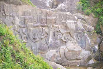
Poor integration, primarily due to its remote location, has been the bane of Tripura, causing slow development and inadequate infrastructure. The jute industry of undivided Bengal and its decline due to partition has been much talked about. However, on the eastern border of Bangladesh, the partition affected and continues to affect the Tripuri people in very significant ways. Besides the problem of illegal immigration which continues from the time of partition, with Hindu families seeking refuge in India to those coming to gain a piece of the Indian growth story, the more pressing problem for this Northeast state is that of surface transport. With the rail-network practically non-existent beyond Guwahati, road remains the only viable means of travel.
The current land route to far-flung Tripura from Kolkata, the nearest metro, has to cross the ‘chicken neck’ territory or the ‘Siliguri Corridor’. The land route through Guwahati is almost 1700 kms long – a distance which can be reduced to less than a fourth (around 400 kms) if the cities of Kolkata and Agartala can be linked through Dhaka.
The importance of this has been recognised, and four years after the commencement of the Kolkata-Dhaka bus service, the Agartala-Dhaka bus from Akhaura in Tripura was flagged off in 2003. Spanning a distance of approximately 100 kms, the road link has given a large fillip to the age old relationship between the tribes of the Northeast and the people of eastern Bangladesh. The service is limited and often marred by the slightest unrest on either side, yet the fact that there is thought on these lines is heartening in itself.
The economy of Tripura remains primarily agrarian with an astounding ninety-one percent of agricultural land utilised for the cultivation of rice. Brickfields and tea remain the only significant industrial output. The discovery of significant reserves of natural gas and their utilisation to generate electricity has brought some optimism to the economic scenario, though until the geographic isolation and communication bottleneck along with insufficient infrastructure are not addressed, the overall scenario remains bleak.
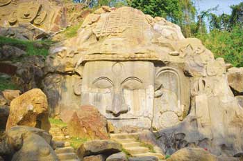
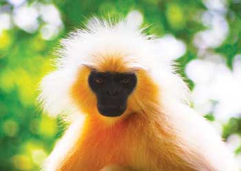
Like all the other states in Northeast, the remoteness creates a natural bounty with over fifty percent of the state under forest cover and home to several endemic species as well as a great migratory stopover for birds of the subcontinent and beyond. It is especially lucky to have the largest number of primate species as compared to any other Indian state, while the interspersion of bamboo and cane forests with evergreen and deciduous flora is a peculiarity of Tripura’s ecosystem.
Only the beginning
It would be presumptuous on many levels to even imagine that such a brief account of such varied groups of people in a significantly large chunk of the country, would instantly help those who have never had the fortune to visit the Northeast, to form any kind of intimate bond with the geographical region or its dwellers. It is too little to vanquish and subdue forever the age old demons that rest in ‘us’ and ‘them’. There is so much more than can ever be covered in any sort of publication and others – the smells, sounds, the thrill and the awe which can never be translated through the limited medium of printed text and photos. However, the wise counsel states that whatever is ideal and necessary to do should always be done without hesitation and too much thought. And that is just what this is – a beginning.
Even if it were well begun, like the popular and true aphorism states, it is only half done; and that is especially apt for this moment as we are only halfway through our exploration of this paradise still waiting for the fog of time and blanket of indifference – that we have just about managed to stir – to blow over. And we shall be at it again, in a month’s time; though not through the chicken neck of irreverent and uncaring pencil pushers, but with the first light that India wakes up to everyday – the land of the dawn-lit mountain – Arunachal Pradesh.

